Map Collection

The Map Collection (Knight Library first floor) has both older and contemporary maps and atlases. The geographic focus is on Oregon and the Pacific Northwest. However, we also have extensive collections of select other regions. Most of our maps are in the open Map Collection where you may access and use maps any time Knight Library is open.

Many of our maps are not listed in the online catalog. You browse the map cases by call number, which groups maps by geographic area. A call number key is posted on the map cases. See Locating Maps in Our Collection for more information.

Our older and more fragile maps and atlases require library staff to retrieve them for you.  If you want to use a map in the Maps Rare location, you may submit a request via the Mediated Map Access Form or Contact Us directly.  Please contact us if you are looking for older maps and you do not find what you want in the browsable collection.
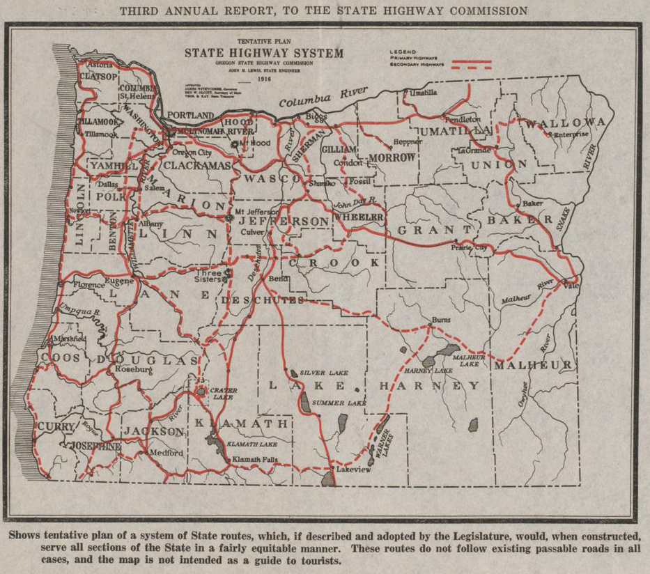
Map of Oregon from 1916 with tentative highway system

Collections and Resources

Topographic Maps
 
United States National Map Series (USGS topographic maps): Our collection has the most recent printed 7.5’ (1:24,000 scale) topographic quadrangles for Oregon and adjacent states. These maps pre-date 2006 when USGS switched to a print on demand system. However, they are still useful as the newer (born digital) maps do not include all the features that were shown on the print maps. We also have a set of the 30’ (1:100,000) and 1° (1:250,000) for the United States. 
Current and older versions of USGS topographic Maps may be viewed and downloaded at TopoView. The UO Libraries also keep a print collection of the older USGS topographic maps in the Rare Map collection. 
International Topographic Maps: The UO Libraries also has an extensive collection of International Topographic maps.
Sanborn Fire Insurance Atlases
 
Starting in the 1800s Sanborn Map Company produced detailed, building level, maps of towns and urban areas. Our map collection contains original prints, microfilm, and microfiche of many Oregon Towns. Form more information about our collection and available Online Resources, see our Sanborn Maps guide.
Metsker Plat Atlases
 
Metsker's Atlases of Oregon Counties, primarily for the 1930s-1960s, depict property owners and donation land claims. Our collection has a number of these atlases which are useful for locating information on historic land ownership.  For more information on the Metsker atlases collection, see Metsker Maps.
Pacific Northwest Federal Lands
 
We have an extensive collection of both old and recent maps of U.S. Forest Service Lands and Bureau of Land Management Lands.  These can be located by searching the Online Catalog. The older maps are of interest to people looking for the locations of old forest roads, structures, and right of ways that are not on recent maps. More information on the Libraries’ physical holdings can be found at Federal Lands Maps.
Geology Maps
 
We have an extensive cataloged collection of geology maps covering Oregon and other parts of the United States. Oregon Department of Geology and Mineral Industries (DOGAMI) maps and U.S. Geological Survey maps and publications are also available online.

Contact Digital Library Services

Indicates required field
CAPTCHA
Just type "yes"
This question is for testing whether or not you are a human visitor and to prevent automated spam submissions.