 Many of our historic maps are in the UO Libraries' Catalog. Maps that are part of large sets are most likely described by one of the links below. Some of these lists refer to maps that may not be held at the UO Libraries. Geographic Information Systems and interactive maps are found elsewhere.
For help finding maps, check out the Digital Maps & Mapping. There are numerous options for copying maps.
Pacific Northwest Federal Lands
- Finding Oregon National Forest, Parks, and BLM Maps
Use this page to find out where to browse in the MAP Library for maps of these areas. - Maps of Oregon National Forests
Includes defunct forests and items which the Library does not hold. Please note: this list is no longer maintained. Use the Library Catalog or speak to a librarian for the best information about the Library's collections. - Maps of Washington National Forests
Includes defunct forests and items which the Library does not hold. Please note: this list is no longer maintained. Use the Library Catalog or speak to a librarian for the best information about the Library's collections. - Forest Atlas of the National Forest of the United States
Please note: the Map & Aerial Photography Library does NOT own these maps.
Class Sets
Multiple copies of maps for UO classroom use. Please contact the Contact the Map Collection for more information.
General Land Office Plats and Maps
General Land Office Survey Plats of Oregon were made from the 1850s through the early-20th century. They are some of the most detailed maps existing about land-use and ownership during white settlement of Oregon. For more information about the UO Libraries' collection and accessing online resources see the General Land Office (GLO) Records.
Geologic Maps
International Topographic Map Sets
Oregon Department of Transportation (ODOT) Historic Sets
- City & Town Maps 1960 - Present
- Vicinity Maps 1974 - Present
- Street Surface Maps 1937-1939
- The library also has collections of:
- General Highway County Maps
- Transportation (County) Maps
- Oregon State Parks 1965-1980
- Traffic Station (County) Maps (older versions in storage. Current editions online from ODOT and printed copies in the public area of the MAP Library filed under G4291s .P2 s100 .O7
Sanborn Fire Insurance Maps of Oregon Cities and Towns
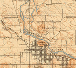
USGS Topographic Maps of Oregon
Current USGS topographic maps can now be freely downloaded as PDFs directly from the USGS website.
- 1°(1:250,000) & 30' (1:125,000) Topographic Quadrangles, 1889 to 1942
- <15' (1:62,500) Topographic Quadrangles, 1897 to 1974
- 7.5' (1:24,000) Topographic Quadrangles, 1949 to present
A guide to all of our USGS Topographic Maps